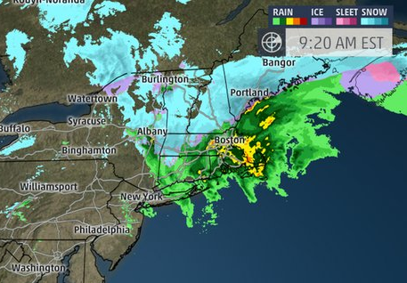
MANCHESTER, NH — As of 10 a.m the big flakes are floating around in the Greater Manchester area, for a snow globe effect. That’s due to a low pressure system which developed into a nor’easter off the East Coast Saturday. The National Weather Service says we will miss the brunt of the storm, as the snow changes over to rain for a bit midday before reverting back to snow. Still, we should only see about 3 inches of accumulation in the end.
A Winter Weather Advisory remains in effect until 4 p.m. Saturday.

* Hazard types: Mixture of snow, sleet and freezing rain.
* Accumulations: 1 to 3 inches of snow.
* Timing: Snow will continue through Saturday afternoon. The snow will mix with or change to sleet and freezing rain for a time on Saturday.
* Impacts: Reduced visibility and dangerous driving conditions.
* Winds: North 5 to 10 mph.
* Temperatures: In the lower 30s.
A Winter Weather Advisory means that periods of snow, sleet, or freezing rain will cause travel difficulties. Be prepared for slippery roads and limited visibility. Use caution while driving.
The rest of the week looks like occasional flurries, and mostly clear skies. Temperatures should dip into the single digits overnight Monday, but otherwise it’s winter in New Hampshire (high temperature 10 days out is 42 F.)
You can click here to play around with the Weather Underground interactive Wundermap.


