Thursday’s weather: A raw March day, rainy with temps in the upper 30s

Sign Up For Our FREE Daily eNews!

weather graphic 2 20

Thursday’s Weather

Overall, a raw late March Day with cold rain. Gusty easterly to northeasterly flow will keep temps in the upper 30s.


Springing Back to Life
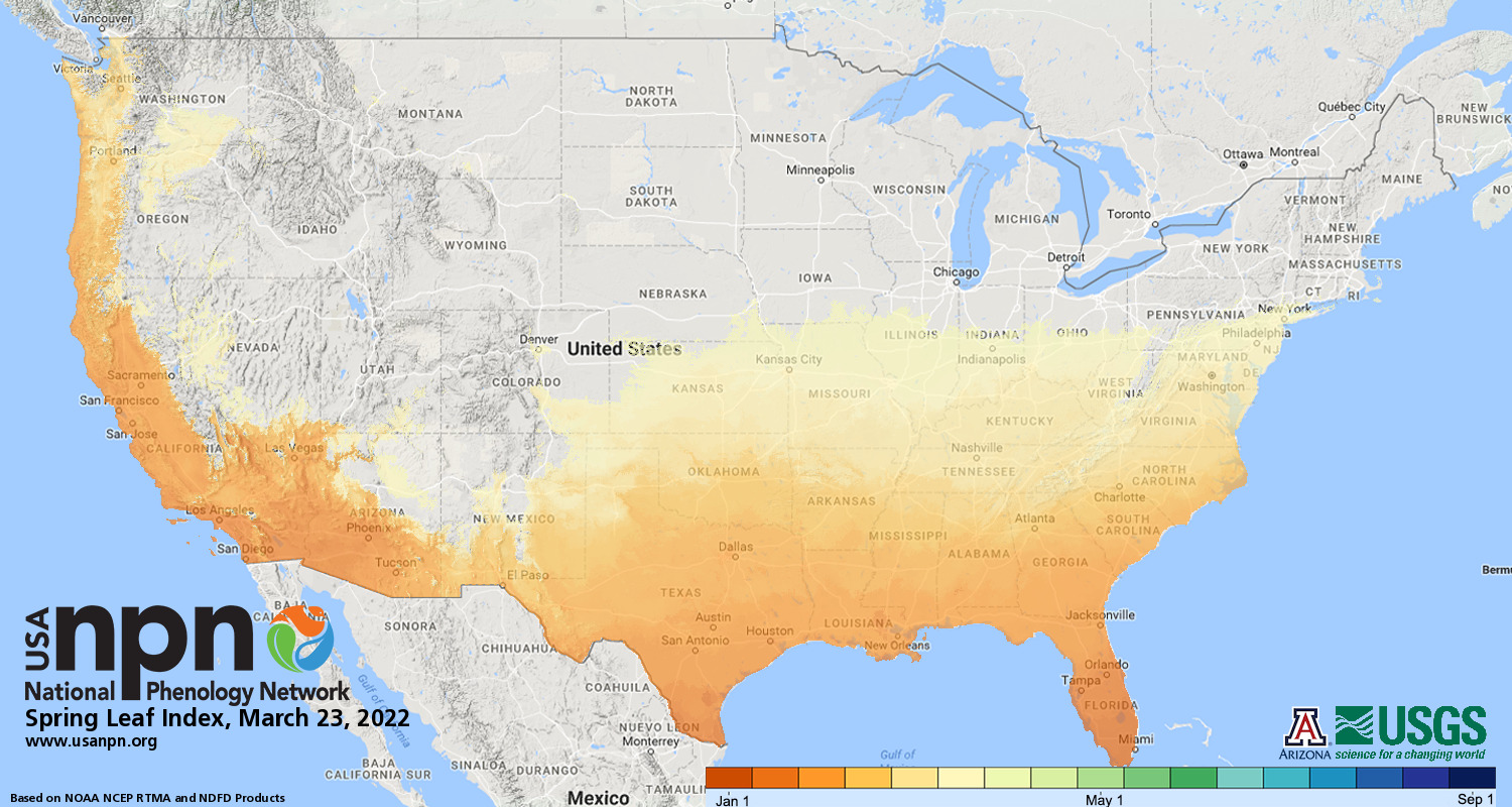
The map below shows where the trees have leaves. Gradually getting closer!
Washington, D.C.’s cherry blossoms hit their peak early. Aided by unseasonably warm weather since mid-February, Washington, D.C.’s famed cherry blossoms hit peak bloom on Monday. This year’s peak is 10 days ahead of the recent 30-year average of March 31. Next Monday morning Washington’s low could be in the upper 20s killing the cherry blossoms!

six leaf


5-Day Outlook March 23- March 27

Today: Cloudy and breezy with a cold rain (.40″). High 39 Winds: ENE 10-15+ mph
Tonight: Cloudy with periods of rain and drizzle (.25″). Low 39 Winds: NNE 10-15 mph
Friday: Partly to mostly sunny and milder. High Near 60 Winds: W 10-15 mph
Friday night: Partly cloudy. Low 39 Winds: W 5-10mph
Saturday: Partly sunny with a spot shower. High 54 Winds: W 5-10 mph
Saturday night: Mostly cloudy. Low 36 Winds: Light & Variable
Sunday: Mostly cloudy and cooler with some showers. High 45 Winds: WNW 5-10 mph
Sunday night: Colder with light snow (1-2″) Low 25 Winds: NW 10-15+ mph
Monday: Cloudy windy and cold with passing snow showers. High 29 (feel like the teens) Winds: NW 15-25 mph
Monday night: Blustery and cold with evening snow showers. Low 18 (feel like 6) Winds: NW 10-20 mph

Weather Patterns We’re Watching

Spring snow is possible Sunday night into Monday! The rest of March’s temperatures will be below normal.

Be an Official Ink Link Weather Spotter!

Rick Gordon could use your help. If you are interested in becoming a local weather spotter (all locations around NH) contact Rick at gordonwx@comcast.net and he’ll walk you through the process!

FullSizeRender 12
Winter Weather Watcher says: You, too, can be a weather watcher.

Ski Report via Ski NH

Screenshot 2021 12 29 6.57.28 PM e1640822371343

Summits above 4,000 feet in Northern New Hampshire Today:
Summits obscured. Sleet with a chance of snow. Highs in the upper 20s. Southeast winds 25 to 35 mph with gusts up to 45 mph. Chance of precipitation 90 percent. Wind chill values as low as 1 below in the morning.
Elevations between 2,500 and 4,000 feet in Northern New Hampshire Today:
Summits obscured. Snow and sleet. Highs around 30. Southeast winds 20 to 30 mph. Chance of precipitation 90 percent. Wind chill values as low as 3 above.


About this Author

Rick Gordon

Rick is a native of Red Hill, PA, and is a former Chief Meteorologist at WMUR-TV. He currently teaches ninth-grade physical science at Central High School. His past adventures in weather-watching include a stint as on-air meteorologist for WSEE in Erie, PA; meteorologist with D&M Weather Services in Pittsburgh, PA; AccuWeather in State College, PA; and weather guy for KDKA radio in Pittsburgh. He studied meteorology at Millersville University in Lancaster, PA (aka God’s Country) and currently lives in Wells Beach, Maine. 

Twitter