Weather Watch Video
Monday’s Weather
High pressure builds in today with some morning sun followed by clouds. A complex winter storm will be bringing moderate snow to the region later tonight into tomorrow for a slow morning commute.

WINTER STORM WATCH IS IN EFFECT FROM LATE TOMORROW NIGHT THROUGH TUESDAY NIGHT
Several inches to perhaps a foot of snow could be unleashed from the storm tomorrow should it develop to its full potential. This would be most likely to occur in the high terrain north and west of Manchester.
WHAT…Moderate to heavy snow is possible. Total snow accumulations greater than 6 inches possible.
WHERE…Manchester north & west. WHEN…From late tomorrow night through Tuesday night.
IMPACTS…Periods of moderate and heavy snow may produce periods of low visibility to create hazardous driving conditions. The hazardous conditions could impact tomorrow morning and evening commutes.
PRECAUTIONARY/PREPAREDNESS ACTIONS… Monitor the latest forecasts on Manchester Ink Link.
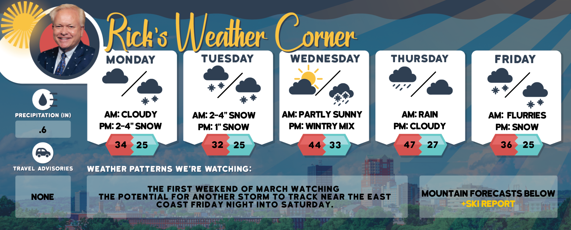
5-Day Outlook, Feb. 27-March 3
Today: Some sun then clouds. High 34 Winds: N 5-10 mph
Tonight: Cloudy with snow (2-4″) Low 25 Winds: E 5-10 mph
Tuesday: Periods of snow (2-4″) & breezy. High 32 (feel like 24) Winds: E 10-15 mph
Tuesday night: Snow to flurries (1″) some clearing late. Low 25 Winds: Light & Variable
Wednesday (March 1): Milder with some sun & clouds. High 44 Winds: WNW 5-10 mph
Wednesday night: Clouding up with some snow mixed with rain late. Low 33
Winds: Light & Variable Thursday: Cloudy & mild with periods of rain showers. High 47 Winds: NW 5-10 mph
Thursday night: Partly cloudy. Low 27 Winds: WNW 5-15 mph
Friday: Clouding up with some snow by evening. High 36 Winds: NNW 5-10 mph
Friday night: Potential for a winter storm with snow. Low 25 Winds: NNW 10-15 mph
Weather Patterns We’re Watching
The first weekend of March watching the potential for another storm to track near the East Coast Friday night into Saturday.
Click for New Hampshire Ski & Boarding Report
White Mountains Weather
The forecast for summits above 4,000 feet in Northern New Hampshire:
Today – Summits obscured. Highs around 17. Northwest winds around 30 mph becoming west around 15 mph in the afternoon. At elevations above 5000 feet, northwest winds around 50 mph become west and decrease to around 20 mph in the afternoon. Wind chill values are as low as 31 below.
The forecast for elevations between 2,500 and 4,000 feet in Northern New Hampshire:
Today – Summits in and out of clouds. Highs around 20. Northwest winds around 30 mph with gusts up to 50 mph becoming west around 15 mph with gusts up to 25 mph in the afternoon. Wind chill values are as low as 22 below.


