MANCHESTER, NH – Today is a snow day. You will find the National Weather Service’s extended forecast, below.
Accident reports are streaming in from the NH Department of Transportation, with a rollover crash at the 101/93 split northbound reported at 8:33 a.m. in the median, mile marker 19, and several accidents piling up here in the city. You can follow along via Nixle.
As of 10:30 a.m. police were searching for an 81-year-old man who was reported missing by his family after failing to return from his morning walk. Just after 1 p.m. police reportedly found him with an assist from police dog Sonny in a wooded area near Crystal Lake. No immediate word on his condition.
At 3 p.m. Chief Nick Willard urged residents to stay off the roadways, reporting nearly two dozen accidents on city roads.
A snow emergency has been called in Manchester for overnight Feb. 9 into Feb. 10. No parking on city streets between 10 p.m. and 6 a.m., and City Hall announced that all city departments will close at 1 p.m. today, scheduled to reopen at 8 a.m. on Feb. 10.
Department of Public Works has suspended all trash collection operations for the day. Residents who have trash pick up on Thursdays should put their items out on Friday. Residents who have pickup on Friday may experience delays of up to 24 hours.
Please stay off the roads, and find a safe place to park your car for the duration to allow plows to clear the roads.
Keeping up with the snow totals in times like these calls for a little ingenuity, coupled with investigative journalism and fun.
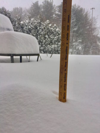
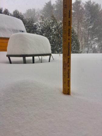
So, I have devised a simple, somewhat unscientific method of chronicling the snow totals here in Manchester today.
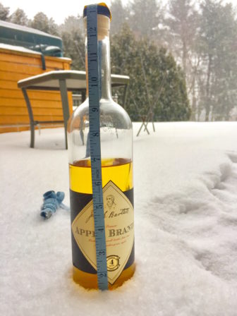
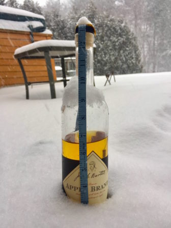
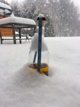
I stuck my measuring tape to my delightful Josiah Bartlett Apple Brandy bottle, purchased locally at Flag Hill Vineyard in Lee, NH, and stationed it just out of reach, on the back deck. I will report hourly on snow totals. If we exceed 13 inches of snow, I will allow myself to abandon the experiment and imbibe.
Fun, right?
- 8:30 a.m.: About an inch of snow. Check back for the hourly update.
- 9:30 a.m.: About 3 inches of snow.
- 10:30 a.m.: Up to about 6 inches
- 11:30 a.m.: Just below 10 inches
- 12:30 p.m.: Bottle submerged – 13 inches
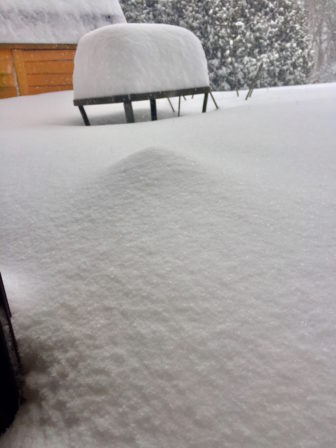
- 1:30 p.m.: Losing sight of bottle. Must. Find. Yardstick!
- 2:30 p.m.: Resorted to yardstick, which is registering 14 inches. Still snowing.
- 3:30 p.m.: Bottle hump is fading into the snow mound, closing in on 15 inches, but wind conditions are affecting the mound. Still snowing.
- 6:15 p.m.: Snow seemed to hold steady at just shy of 15 inches, night has fallen, the wind is howling and the snow has stopped.

Official synopsis from the National Weather Service: 12+ inches
A Winter Storm Warning remains in effect until 7 p.m. on Feb. 9. Total accumulation expected to be 8-12 inches.
From the Weather Underground:
A very active storm pattern continues through the start of next week. Low pressure will intensify over the Gulf of Maine today bringing widespread snow to the area. High pressure will briefly build in Friday. On Saturday warm air advection ahead of a weak disturbance will bring a few inches of snow to the region. Another stronger system will impact the region Sunday night into Monday with more snow.
 Near term until 6 p.m. Thursday
6:55 a.m. Forecast fairly well on track this morning. Snow may be arriving a bit early in NH, but only by an hour, and heaviest snow will hold off until mid-morning into this afternoon, when best combo of mid-level fog/deformation sets up across southeast New Hampshire zones and just off the ME coast.
Previously, all in all, weather models are in fair agreement and support previous models runs concerning today’s rapidly intensifying coastal low. If there were any changes to the forecast it was to bring up snow amounts a little, and increase winds a bit as well. These tweaks shifted Belknap County to a warning and put north Carroll into advanced. Snow develops early this a.m. over NH, and by mid morning most everywhere else. In the warning area snow will be heavy at times especially from late morning
into the afternoon.
Given the rapidly development of the storm, particularly the very impressive mid-level development today, should be strong deformation and frontogenesis, especially along the coast. It is here where snowfall rates of 1-3″ an hour will possible. The most snow looks to fall over seacoast NH, back through Manchester, and the into York County. Here, could see close to a foot. Interior parts of southern New Hampshire and the coastal plain of ME will like see 6-10″ as the best banding will tend to stay offshore here. Further inland, in the mountains and foothills, accumulations will range from 3-6″ on average. North winds will increase this morning and could gust to 30-40 mph, and this combines with heavy snow, could approach blizzard conditions briefly at times in heavier snow bands near the coast. Temperatures will fall through the day and will be in the single digits north, to the teens in the south by late afternoon.
This will produce wind chills below zero in the north and approaching zero in the south this afternoon.

