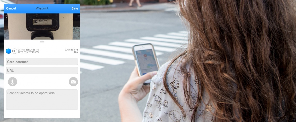
 I’ve always been fascinated by maps. As a young girl, I spun globes and looked through atlases, dreaming of different places and creating stories in my mind. From cartography’s early days, map making has been a creative process that’s shaped how people perceive themselves and the world. For thousands of years, this was done through drawings and handcrafted maps. These maps influenced how stories were told and information was shared. Making maps is no less creative now, but with new technology there are so many new possibilities for who can create and share innovative and informative maps and connect through the stories they tell.

That’s why I love talking to Shane Bradt, a geospatial technology/water quality state specialist with UNH Cooperative Extension. Bradt has seen these possibilities firsthand. It’s what inspires him to conduct a range of ArcGIS and mobile mapping workshops on using your smartphone or a web browser to make and share digital maps. To him, one of the most exciting changes with advances in technology is that creating maps is not limited to people with technical training and expensive software.
“There are lots of tools for people who want to invest a little time to create and share maps,” Bradt says. “People can share information and tell their own stories in a way that is more compelling and interactive. They have the ability to connect with others this way.”
When maps first transitioned from paper to the digital realm, there was a high barrier to entry. Only trained professionals were able to understand and use the online tools. Although there are still many professional uses, Bradt says mobile mapping doesn’t necessarily require tech genius. “People still have to understand data and some basics,” Bradt says, “but with phones, there are many different ways to do that now.”
Bradt says people are sometimes surprised by the fact that some story maps don’t require maps at all.
“It’s about sharing information online in a compelling way and allows people to communicate in a way they weren’t able to previously. The tech piece is no longer the biggest challenge. You are really creating an interactive web page without needing a high level of expertise,” Bradt adds. “You are creating a story with a bunch of different content: videos, pictures, text and sometimes maps.”

Bradt’s workshops appeal to a wide audience. Some sessions are for geographic information system professionals who want to increase their skills in a professional capacity. Others attract teachers and students who want to integrate ArcGIS and mobile mapping into classrooms or nonprofit organizations that want to map trail networks, collect data or respond to problems.
He shares one example of how mobile mapping helped with a clean-up effort around Great Bay. Volunteers collected data on the locations and types of trash and used the data to organize a cleanup strategy. There are also personal uses: Folks can map their own land or the trails they hike or share stories about their favorite places.
Workshop participants are surprised by the connections and potential uses of ArcGIS and mobile mapping they discover, both for personal and professional use, according to Bradt. They come in with one idea and have many more ideas by the end. He calls his workshops a “guided way” to see this potential, but notes that some are almost embarrassed when they discover a personal use. He loves when this happens. “You are more likely to get your head around it if it’s something you connect with personally.”
To learn more, check out some story maps here or consider taking a workshop. You may just become as
fascinated by maps as I am.
 In her role as the STEM Discovery Lab Coordinator, Emily supports the collaborative effort between UNH Cooperative Extension and UNH Manchester of the STEM Discovery Lab located on the Manchester campus. Emily was an English as a Second Language and English Language Learner educator for youth and adults in the greater Manchester and Seacoast areas for over 8 years and was the project assistant for the GATE CITY Project (Getting All Teachers ESOL Certified in Two Years) at UNH Manchester from 2012 to 2015. Emily earned her B.A. in international studies from The Ohio State University and her M.Ed. in secondary education from UNH Manchester. She is the mother of two active teenage boys and loves spending time outdoors.


